Our Technology
Sensors
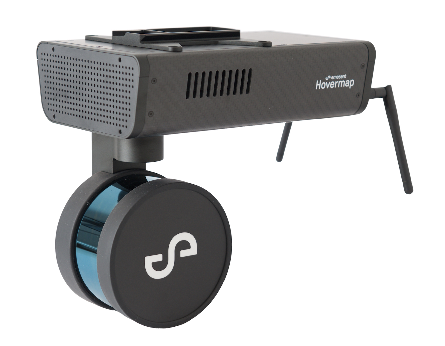
Emesent Hovermap LiDAR
- Portable – drone mounted, vehicle, or hand carried operations
- +/- 30 millimeters pre-processed accuracy
- Unmatched point density and reflectivity
- Colourized option available
- +/- 15mm survey grade accuracy with control
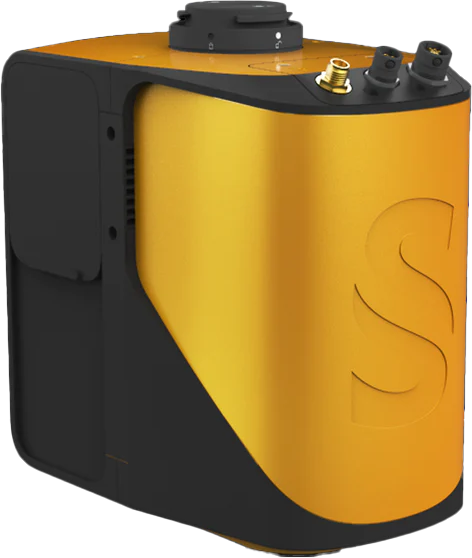
YellowScan Mapper LiDAR
The YellowScan Mapper LiDAR offers exceptional flexibility and capability, seamlessly integrating with a variety of UAV platforms. This LiDAR system provides unparalleled safety margins, particularly in challenging environments, and has demonstrated reliability in GPS-denied conditions, making it suitable for diverse applications.
Compatible Airframe: DJI M300 RTK
Sensor Type: LiDAR (Light Detection and Ranging)
Primary Use: Mapping and surveying, accurate 3D point clouds, terrain mapping, vegetation analysis, and topographic surveys.
- Achieves +/- 30 millimeters pre-processed accuracy
- Ensures precise and reliable data for mapping and surveying tasks
- Unmatched Point Density and Reflectivity
- Offers a colorized data option for enhanced visualization and analysis
- Achieves +/- 15mm survey grade accuracy with control
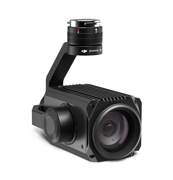
Zenmuse Z30 - DJI
Compatible Airframe: Matrice 210-RTK
Sensor Type: High Zoom RGB
Primary Use: Inspection
- 30x Optical Zoom for Great Detail Retention from Great Distance
- 6x Digital Zoom
- Smart Target Tracking and Tap-to-Zoom Functions
- Rated for Operations between -10C to 45C
- Pair with XT2 (see above) for Powerful Inspection Tandem
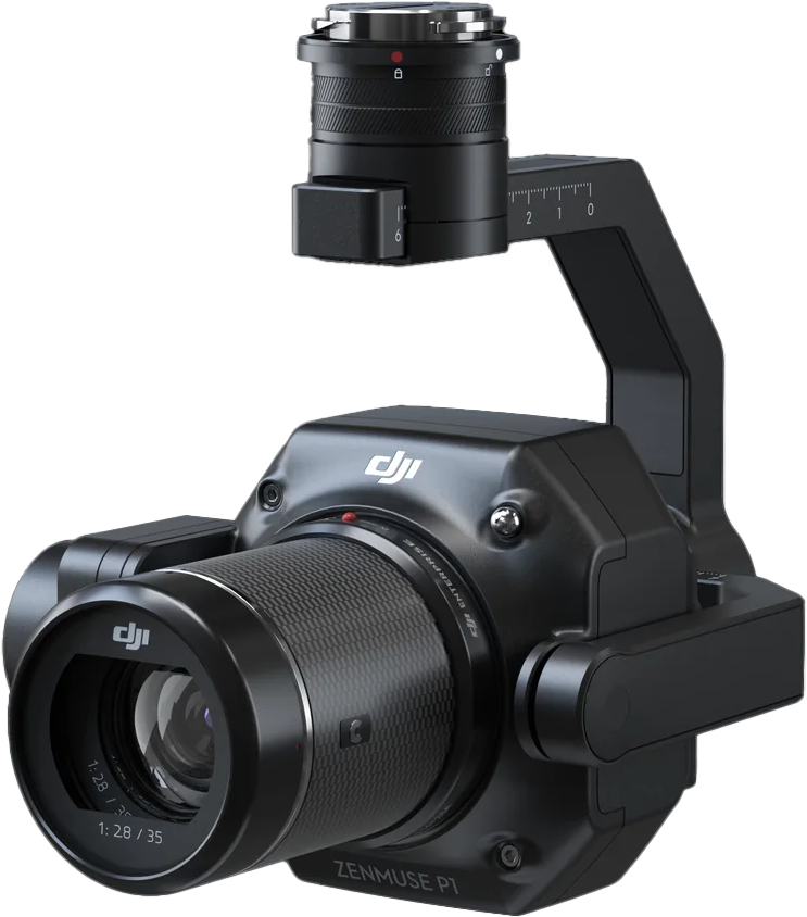
Zenmuse P1
Compatible Airframe: DJI Matrice 300 RTK
Sensor Type: High-resolution full-frame sensor
Primary Use: Engineered for professional mapping and surveying applications, providing accurate and detailed geospatial data.
- 45-megapixel full-frame sensor
- Supporting interchangeable lenses
- Equipped with a global mechanical shutter
- Engineered for survey-grade accuracy
- Incorporates TimeSync 2.0 technology, synchronizing the camera, GPS module, and flight controller for optimal data capture accuracy.
- Supporting smart oblique capture
- Combined with DJI's RTK technology, the Zenmuse P1 achieves centimeter-level positioning accuracy
- Integration with Onboard D-RTK 2 GNSS Module
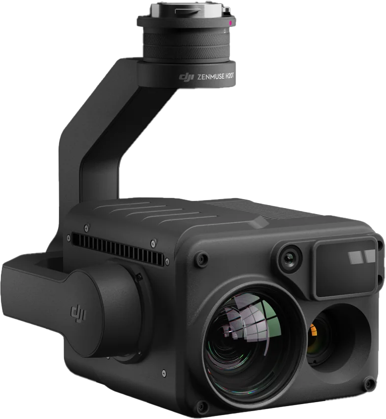
Zenmuse H20T - DJI
Compatible Airframe: Matrice 300 RTK
Sensor Types: Multi-Sensor Payload including Thermal Imaging, Zoom Camera, and Laser Rangefinder
Primary Use: Comprehensive Aerial Inspection and Mapping
- High-Resolution Thermal Camera
- 20MP 23x Hybrid Optical Zoom Camera
- Laser Range Finder for long-range distance measurement and precise distance data for accurate mapping
- Achieves Survey Accuracies as low as 1cm
- Flexible Ground Sampling Distance (GSD)
- Efficiently Covers Large Areas for Mapping and Surveying Projects
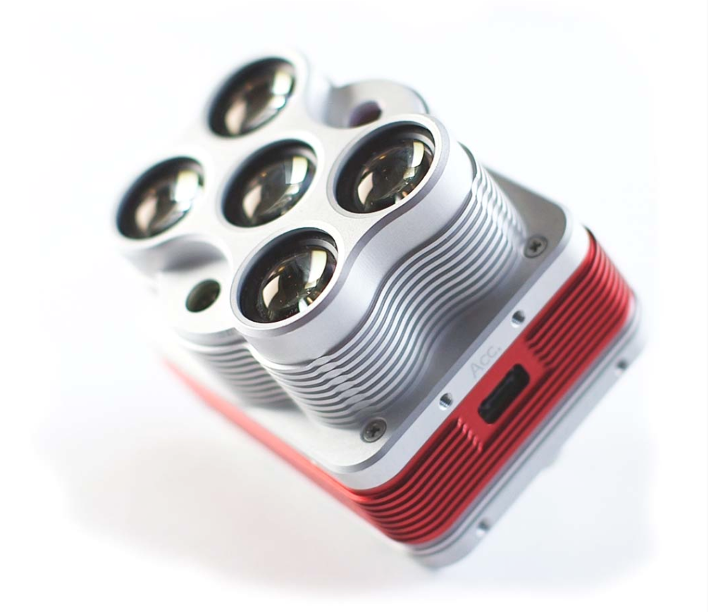
Altum - Micasense
Compatible Airframe: Trinity
Sensor Type: 6x Narrow Band Multispectral
Primary Use: High Resolution Calibrated Reflectance Image Capture
- Blue, Green, Red, Near Infrared, Red Edge and 2x Infrared Sensors
- 5.2cm per pixel GSD at 120m
- One Capture per Second
- Calibrated Reflectance Plate for Mean Reflectance Accuracy of 95%
- Downwelling Light Sensor for Cloud Cover Adjustments
- Exciting Reclamation, Forestry, and Agriculture Applications
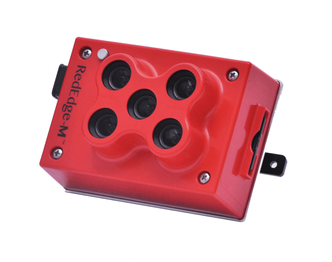
Rededge M - Micasense
Compatible Airframe: Matrice 210-RTK & Wingtra One
Sensor Type: 5 Band Multispectral
Primary Use: Calibrated Reflectance Image Capture
- Blue, Green, Red, Near Infrared and Red Edge Sensors
- 8cm per pixel GSD at 120m
- One Capture per Second
- Downwelling Light Sensor for Cloud Cover Adjustments
- Calibrated Reflectance Panel for Accurate Values
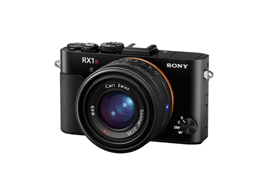
RXIR II - Sony
Compatible Airframe: Trinity, M600
Sensor Type: Very High Resolution RGB
Primary Use: High Detail, Survey Grade Site Mapping
- 1.7cm per pixel GSD at 120m
- GSD as low as 0.7cm per pixel for ultra-high-resolution applications
- Survey Accuracies as low as 1cm
- 42MP full-frame Sensor
- Up to 210 hectares coverage per flight at 120m (60% sidelap)
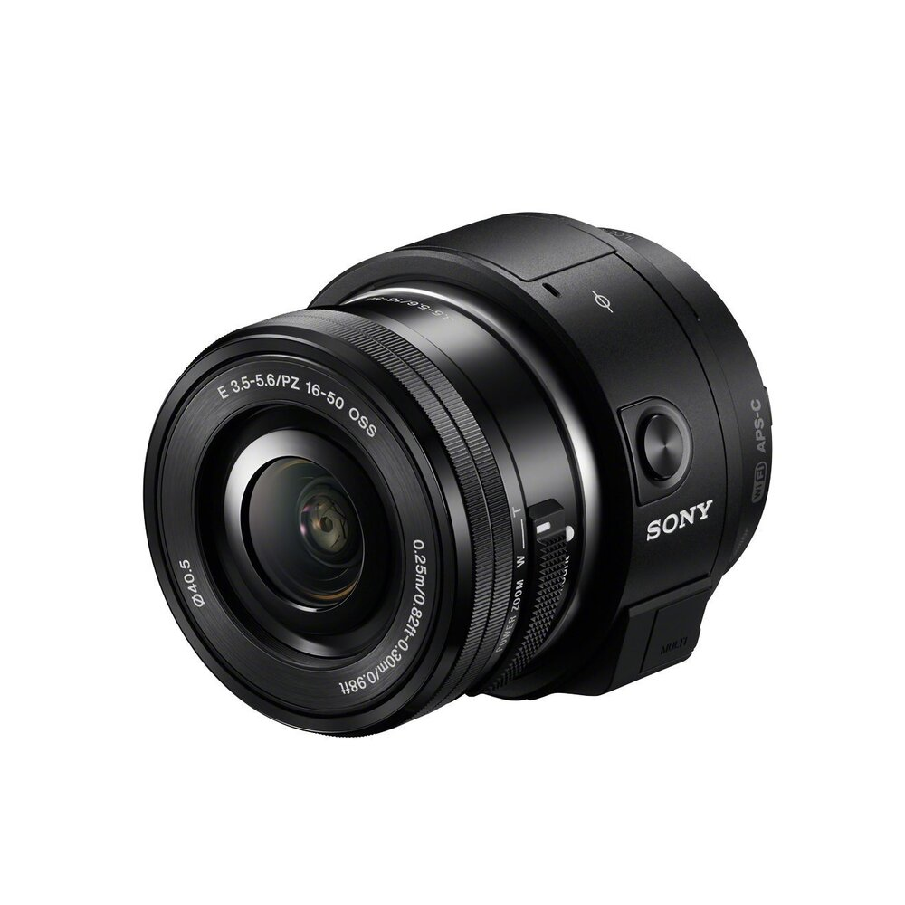
QX I - Sony
Compatible Airframe: Wingtra One
Sensor Type: High Resolution Variable Angle RGB
Primary Use: 3D Modeling and Site Mapping
- 3.1cm per pixel GSD at 120m
- Wide Angle 15mm Lens for Enhanced 3D Digital Reconstruction
- Survey Accuracies as low as 3cm
- 20MP APS-C Sensor
- Up to 320 hectares coverage per flight at 120m (60% sidelap)
More Solutions from Osprey Integrity
We're Ready to Help!
Whether you have a question about our operations or a job that needs completing, we have the answer!